Most people who show up at the Santa Barbara hot springs for the first time end up standing in a creek bed, phone held up for signal, wondering if they missed a turn. They didn’t — the trail really is that easy to lose. Here’s everything you need to actually find the pools, park legally, and enjoy them without turning it into a headache.
The Santa Barbara hot springs — officially Montecito Hot Springs, reached via the Hot Springs Canyon Trail off East Mountain Drive — is a 2.5-mile round-trip hike gaining about 700 feet to a series of natural mineral pools running 100–104°F. Parking is extremely limited and now restricted during fire-risk days.
What Are the Santa Barbara Hot Springs?
When people say “Santa Barbara hot springs,” they almost always mean the pools tucked into the hills above Montecito, a small, wealthy community that borders Santa Barbara on its southeast edge. Technically these are the Montecito Hot Springs, sitting on land managed by the Los Padres National Forest, not within Santa Barbara city limits. That distinction trips a lot of visitors up when they type the address into Google Maps and end up nowhere near a trailhead.
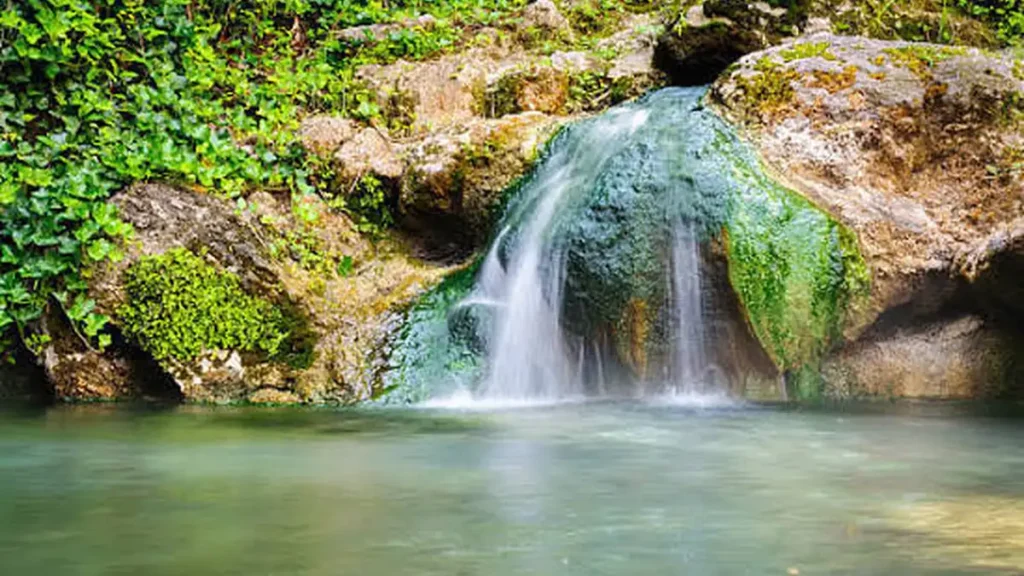
The pools themselves are naturally occurring, fed by geothermal springs rather than piped or maintained by anyone. That’s part of the appeal — there’s no ticket booth, no staff, no bathhouse. It’s also why the pools can look completely different depending on when you show up: bigger after a rainy winter, half-collapsed after a dry summer, sometimes rebuilt by hikers between visits.
Hot Springs Canyon Trail Stats and Directions
The hike is officially called the Hot Springs Canyon Trail, though you’ll also see it listed as just “Hot Springs Trail.” Here’s the honest breakdown:
| Stat | Detail |
|---|---|
| Round-trip distance | About 2.5–2.6 miles |
| Elevation gain | Roughly 700–800 feet |
| Distance to the pools | About 1.25–1.4 miles one way |
| Time | 1.5–2 hours round trip for most hikers |
| Difficulty | Moderate — steady climb, a few steeper pushes |
| Trail surface | Dirt, rocky in sections, several creek crossings |
The climb is consistent rather than brutal. It’s a gradual ascent the entire way — enough to get your heart rate up without leaving you gasping. You’ll walk alongside Montecito Creek for most of the route, and the flow changes a lot depending on the season.
How to Get to the Trailhead
From downtown Santa Barbara, take US-101 South and exit at Cabrillo Boulevard toward Hot Springs Road, then turn left onto East Cabrillo Boulevard and continue onto Hot Springs Road. Stay on Hot Springs Road, then turn onto East Mountain Drive, which leads to the small trailhead parking area.
Finding the Actual Pools (Where People Get Lost)
This is the part almost every review mentions, and for good reason. The trail isn’t always well marked, and it’s common for hikers to wander off route a few times before finding the springs. The trick: around mile 1.2, right after a sign marking the Montecito Creek Water Co., cross the river and look for a steep path on the far side. One hiking guide describes a similar landmark from the opposite direction — an old man-made foundation near the one-mile mark, where you cross a small creek, then veer left and climb a short, semi-steep stretch to reach the pools. If you hit that foundation and don’t see an obvious path, look left before you look anywhere else.
Quick Takeaway: If you reach a junction and aren’t sure, the pools are almost always up and to the side of the main creek crossing, not straight ahead on the main trail.
Parking Rules You Need to Know Before You Go (2025–2026 Update)
This is the part most guides gloss over, and it’s the one thing that can actually ruin your trip if you skip it.
The trailhead has only eight legal parking spaces, and finding a spot on weekends is close to impossible. For years, the workaround was street parking nearby — but that’s changed.
Red Flag Warning Closures
Following pressure from Montecito residents and growing safety concerns, the Santa Barbara County Board of Supervisors approved a pilot program restricting parking and trail access during Red Flag Warning days, when wildfire danger peaks. The plan pairs parking restrictions and trail closures during elevated fire risk with tighter oversight after heavy rainfall, aimed at stopping unauthorized pool-rebuilding that damages the watershed.
The rule isn’t hypothetical anymore. During an August 2025 heat wave, trail parking was shut down entirely from Thursday morning through Saturday evening under this new heat/fire policy.
Tow-Away Zones and Overnight Restrictions
As of October 2025, tow-away enforcement is active on East Mountain Drive and Riven Rock Road, with no parking allowed from sunset to 8 a.m., and no parking during any active Red Flag Warning. New signage went up in August 2025, and the restrictions are tied directly to the trailhead parking lot’s own closure schedule.
There’s also been genuine friction with neighbors. County officials have sent letters to Montecito residents ordering them to remove boulders and plants placed to block public parking near the trailhead — this isn’t the first time it’s happened, with similar letters going out back in 2022.
What this means practically: before you drive out, check the current fire-weather forecast for Santa Barbara County. If a Red Flag Warning is active, don’t bother — you’ll likely find the lot closed and your car at real risk of a tow if you park on the street anyway. Arriving before 8 a.m. on a calm-weather weekday is still your best shot at a legal spot.
What the Pools Are Actually Like
There isn’t just one pool — there’s a small chain of them stepping down the hillside, and they don’t all feel the same. The uppermost and hottest pool typically runs somewhere between 100°F and 104°F. Lower pools cool off as spring water mixes with creek flow, so the pool closest to the trail at the bottom tends to run lukewarm rather than hot.
That variation is actually useful information most first-timers don’t have going in. If the top pool is packed or too hot for your taste, don’t turn around — the second pool down is often described as warm rather than scalding, and a good compromise when the top pool is overcrowded. On a hot day, even the lukewarm bottom pool can feel good.
Expect crowds. Overcrowding is a common complaint, with visitors sometimes unable to even get into the water after making the full hike up.
Trail Rules, Safety, and Etiquette
A few rules aren’t optional, and ignoring them is a big part of why the county has cracked down:
- No dogs. Leave pets at home — they can disturb the fragile area and contaminate the pools for everyone else.
- No camping, no fires, no presence after dark. Overnight closures are now actively enforced with towing, not just signage.
- No pool rebuilding. Reshaping the pools after storms is treated as illegal watershed modification and is part of what triggered the new enforcement plan.
- Watch the creek crossings. Several stream crossings sit along the route, and water levels can rise fast after rain — use caution rather than pushing through a crossing that looks high.
- Respect Red Flag Warnings. This area sits in genuinely high fire terrain. It’s been touched by the 2008 Tea Fire, the 2017 Thomas Fire, and the devastating 2018 debris flow, so the county’s caution here isn’t bureaucratic overreach — it’s grounded in real recent history.
Best Time to Visit (and How to Avoid the Crowds)
Weekday visits, especially in the middle of the week, or arriving close to sunset, are your best bet for fewer people on the trail and at the pools. Weekends are consistently the most crowded, and the eight-space parking lot fills accordingly. The small free lot at the trailhead often fills before 8 a.m.
You genuinely can hike this year-round. Santa Barbara temperatures typically sit between 65 and 80 degrees, making winter and spring visits just as pleasant as summer ones. Summer does bring more heat exposure on the exposed sections of trail, so plan for an earlier start if you’re going in July or August.
What to Pack
- Water — summer heat on this trail is significant, and hydration matters even for a short hike.
- Sunscreen and a hat for the exposed stretches
- Shoes with real grip — the trail is rocky in spots and creek crossings can be slick
- A swimsuit and a change of dry clothes for after
- A downloadable offline map — the trail can be tricky to navigate, and downloading the route ahead of time is genuinely useful.
- Cash or a rideshare app, given the parking situation
Nearby Alternative Route: The Cold Spring Loop
If the main trailhead is closed or the eight parking spots are gone, there’s a longer alternative. Starting from the Cold Spring Trailhead on Mountain Drive, you can follow the Cold Spring Trail up the canyon to the Montecito Overlook, then take the Cold Spring–Hot Springs Cutoff to reach the ruins of the old Hot Springs Hotel and the pools themselves, before looping back down the Hot Springs Trail’s fire road to Mountain Drive. It’s longer and involves more climbing, but it spreads foot traffic across two trailheads instead of one — and it passes a swimming hole along the way as a bonus.
If you’re planning another destination too, check out our California travel guides for more trip ideas.
FAQ SECTION
Is Santa Barbara hot springs free to visit?
Yes. There’s no entrance fee or reservation system. The only real cost is finding legal parking, which is limited to eight spaces near the trailhead.
How long is the hike to the Santa Barbara hot springs?
The round trip is about 2.5 miles with roughly 700 feet of elevation gain, taking most hikers 1.5–2 hours including some time at the pools.
Can you swim in Montecito Hot Springs?
Yes, people soak and swim in the pools regularly. Water temperature varies by pool, from around 100–104°F at the top to lukewarm near the bottom.
Are dogs allowed on the hot springs trail?
No. Dogs are discouraged to protect the pools and the surrounding habitat, and most guides recommend leaving pets at home entirely.
Is the Santa Barbara hot springs trail hard?
It’s rated moderate — a steady, gradual climb rather than a technical scramble, though there are rocky sections and creek crossings that require some care.
Where do you park for Santa Barbara hot springs?
The trailhead is on East Mountain Drive in Montecito, with only eight legal spaces. New tow-away rules now apply overnight and during Red Flag Warning fire conditions.
Is Montecito Hot Springs ever closed?
Yes. As of 2025, parking and sometimes the trail itself close during Red Flag Warning fire-weather events, and overnight parking is banned year-round.
What’s the best time of day to visit?
Early morning on a weekday gives you the best shot at parking and a quieter trail; weekends and afternoons are consistently busier.