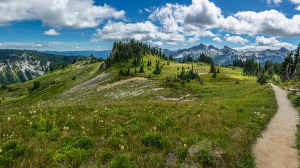
The Pacific Crest Trail has a reputation in Oregon that surprises a lot of first-timers: it’s the shortest state section, and thru-hikers often call it the easiest. That doesn’t mean it’s boring. You’ll walk past an active volcano field, skirt the rim of the deepest lake in the country, and cross more water-scarce stretches than the guidebooks always admit.
The Pacific Crest Trail runs roughly 2,650 miles from Mexico to Canada, and its Oregon section covers about 455 miles — from the California border near Ashland to the Bridge of the Gods at Cascade Locks. Most hikers cover it in three to four weeks, moving through volcanic ridgelines, old-growth forest, and high alpine lakes along the way.
Quick Takeaway
Oregon’s PCT section is shorter and gentler than California or Washington, but permits, water planning, and wildfire smoke still catch people off guard. Plan those three things first.
What Is the Oregon Section of the Pacific Crest Trail?
Entering Oregon from the south, the trail crosses near Ashland and Greensprings Summit, then climbs north through the Cascade Range for the rest of the state. The trail passes through a 43-mile segment near Ashland, winding through wildflower meadows, old growth forests, and juniper hillsides with views of Mount Shasta, Pilot Rock, and the Cascade-Siskiyou National Monument.
Further north, Oregon is mostly forested terrain, which tracks with roughly 60% of the state being covered in forest, and hikers commonly see deer, rodents, and occasional mountain lions along the way. At 456 miles, Oregon is the shortest state on the PCT and is generally considered one of the easier sections, since the eastern and western halves have distinct ecoregions the trail threads between, running over gently sloping volcanic mountains and broad valleys.
That gentler grade is where the nickname “Oregon flat” comes from among thru-hikers — not literally flat, but consistent enough that daily mileage tends to jump compared to the granite switchbacks of the Sierra.
One quirk worth knowing early: Oregon doesn’t route hikers through as many towns as earlier states, so resupply usually means mailing boxes ahead to small lodges rather than walking into a grocery store. More on that below.
Do You Need a Permit? PCTA vs. Central Cascades Rules
This is where a lot of planning goes sideways, because there are two separate permit systems that overlap in the middle of the state.
If you’re thru-hiking 500+ miles: You’ll apply for the PCT Long-Distance Permit through the PCTA. This permit lets you travel and camp on federal land without additional permits, and in Oregon it also helps you avoid the limited-entry permit requirements in the Central Cascades wilderness areas — but it comes with strings attached.
Long-distance permit holders are required to camp within the “PCT Corridor,” which extends half a mile to either side of the trail, though side trips to scenic spots and off-trail resupply runs are still allowed. A handful of popular camps are off-limits regardless of permit type: no camping in Obsidian, North and South Matthieu Lakes, Coyote and Shale Lakes, or Jefferson Park within the Mt. Jefferson, Mt. Washington, and Three Sisters wilderness areas.
If you’re section-hiking under 500 miles: The PCTA Long-Distance Permit isn’t available to you — it’s reserved for hikers meeting the mileage threshold. Section hikers instead need to work out permit requirements directly with the local land management agencies covering whichever stretch they’re hiking. That most often means a Central Cascades Wilderness Permit.
Central Cascades Wilderness Permits are required for all overnight stays in the Mt. Jefferson, Mt. Washington, and Three Sisters Wilderness areas, though Waldo Lake and Diamond Peak Wilderness don’t require them. Day use also requires a permit at 19 of the 79 trailheads across those same three wilderness areas. The season for these runs June 15 through October 15, and they’re released in batches through Recreation.gov, so book early if your dates fall in peak summer.
Quick Takeaway
Thru-hiker with a PCTA permit? You’re mostly covered, but stick to the corridor and skip the closed camps. Section-hiking through the Central Cascades? Book your wilderness permit on Recreation.gov well before your trip — quota trailheads sell out.
When to Hike the Oregon PCT (Snow, Smoke, and Timing)
Most northbound thru-hikers reach Oregon in July, when the Cascade snowpack has mostly cleared from the trail’s mid-elevation route. Section hikers have more flexibility, but a few things shift the calendar:
- Snow lingers into early July at higher passes in wetter years, particularly around Crater Lake and the Three Sisters.
- Wildfire smoke is the bigger wildcard. Late July through September is peak fire season in the Cascades, and closures can reroute or shut down entire segments with little notice — check current Forest Service and InciWeb alerts before you commit to a start date.
- Late September into October often brings the clearest air and fewer bugs, though days get shorter and nights colder at elevation.
Best Section Hikes and Day Hikes in Oregon
You don’t need three weeks to experience this section. Oregon’s road crossings and lodge access make it one of the easier states for shorter trips. Oregon is a favorite for PCT section hikes precisely because it has plenty of resupply points, road crossings, and alternates that make loop hikes far easier than in a section like Northern California.
Crater Lake and the Rim Trail Alternate
The PCT itself doesn’t hug the caldera rim, but most hikers detour onto the unofficial Rim Trail alternate anyway. It trims roughly 5 miles off the standard route while delivering the actual lake views — a rare case of a shortcut also being the better hike. Expect crowds at the rim viewpoints during midday in summer, and carry extra water since reliable sources thin out here.
Three Sisters and Mt. Jefferson Wilderness
This stretch is the scenic core of Oregon’s section: wildflowers and lingering snow patches near Mt. Thielsen make for striking scenery, and the trail’s high point for both Oregon and Washington sits at Tipsoo Pass, roughly 7,560 feet. Camping at Maidu Lake nearby is a common overnight stop for those pacing themselves through this section.
Water discipline matters here more than most guides mention. The stretch past Maidu Lake runs dry for about 13 miles, with Six Horse Spring — reached via a steep climb — as the only reliable source, and trail angels sometimes cache water at Windigo Pass, though it’s not guaranteed.
Quick Takeaway
Loop and out-and-back day hikes are easy to build around Crater Lake, Three Sisters, and Mt. Jefferson trailheads — you get the PCT’s best Oregon scenery without carrying a full pack for weeks.
Pacific Crest Trail Water, Resupply, and Trail Towns in Oregon
Because the Pacific Crest Trail corridor in Oregon skips most towns directly, hikers lean on a short list of trailside lodges that accept mail drops — often at a premium for the convenience, and with limited resupply stock beyond basics. Popular resupply stops include Fish Lake Resort, Shelter Cove Resort, Elk Lake Resort, Big Lake Youth Camp, and Timberline Lodge near the section’s end. Calling ahead to confirm current hours and mail-drop policies is worth the five minutes — small operations change seasonal hours often.
For water, plan meals and camp spots around known dry stretches rather than assuming lakes will appear on schedule. The Maidu Lake–to–Windigo Pass corridor and portions near the high desert transition south of Crater Lake are the two sections that catch people out most.
Pacific Crest Trail Wildlife, Weather, and Trail Conditions in Oregon
Common wildlife along Oregon’s PCT includes deer, various rodents, and occasional mountain lions, though sightings of the latter are rare and typically fleeting. Mosquitoes are the more persistent nuisance, especially in the wetter, lake-heavy stretches through July.
Trail conditions can change fast with wildfire activity. Before any Oregon PCT trip, check:
- Current Forest Service closure orders for the Willamette, Deschutes, Mt. Hood, and Rogue River-Siskiyou National Forests
- PCTA’s trail closure map
- Recent trip reports on forums like Oregon Hikers or the PCTA’s own updates
Finishing the Pacific Crest Trail Section: Cascade Locks and Bridge of the Gods
The Oregon section wraps up with one of the most memorable stretches on the entire PCT. Hikers commonly finish with a steep descent, cross the Eagle Creek Trail alternate when it’s open, or continue on the PCT proper to Wahtum Lake if it’s closed. Along the way, many detour to Timberline Lodge on Mt. Hood for a hot meal — a well-earned reward after weeks of trail food.
The section (and, for many thru-hikers, the emotional halfway-ish milestone into Washington) ends by crossing the Bridge of the Gods into Cascade Locks, a small town on the Columbia River that’s become an unofficial celebration point for northbound hikers.
Quick Takeaway
Save some energy for the final stretch into Cascade Locks — the descent is steep, the Timberline Lodge detour is worth it, and the Bridge of the Gods is the photo everyone takes
Oregon won’t test your legs the way California’s Sierra or Washington’s North Cascades will, but it rewards people who plan around its two real hazards: permit paperwork and dry water stretches. Sort those out ahead of time, and you’ll get one of the most rewarding, least crowded 450-mile stretches on the entire trail.
For more inspiration like this, take a look at our Oregon and Northwest travel guides.
FAQ Section
How many miles is the PCT in Oregon?
Oregon’s Pacific Crest Trail section runs about 455–456 miles, from near Ashland at the California border to the Bridge of the Gods at Cascade Locks. It’s the shortest of the three states the PCT passes through.
Do you need a permit to hike the PCT in Oregon?
Yes, in most cases. Thru-hikers use the PCTA Long-Distance Permit, which covers most federal land requirements. Section hikers under 500 miles typically need a separate Central Cascades Wilderness Permit for the Mt. Jefferson, Mt. Washington, and Three Sisters areas.
What is the highest point of the PCT in Oregon?
The highest point in both Oregon and Washington is Tipsoo Pass, at roughly 7,560 feet, located in the Central Cascades near Maidu Lake.
Is Crater Lake on the Pacific Crest Trail?
The PCT itself doesn’t run directly along the caldera rim, but most hikers take the Rim Trail alternate, which is shorter and passes the lake’s iconic viewpoints.
How long does it take to hike the Oregon PCT section?
Most thru-hikers cover Oregon’s 455 miles in three to four weeks at a steady pace. Section hikers can complete shorter portions, like Crater Lake to the Three Sisters, in under a week.
Is the PCT in Oregon considered easy?
Compared to the Sierra Nevada or North Cascades, yes — Oregon’s volcanic terrain is gentler and more consistently graded, which is why hikers often nickname it “Oregon flat.” It still involves real elevation gain and long dry stretches.
Where does the PCT end in Oregon?
Oregon’s section ends at the Bridge of the Gods in Cascade Locks, where hikers cross the Columbia River into Washington.
What’s the biggest challenge on the Oregon PCT?
Water scarcity on certain stretches (like Maidu Lake to Windigo Pass) and wildfire smoke during peak summer are the two most common issues hikers underestimate.