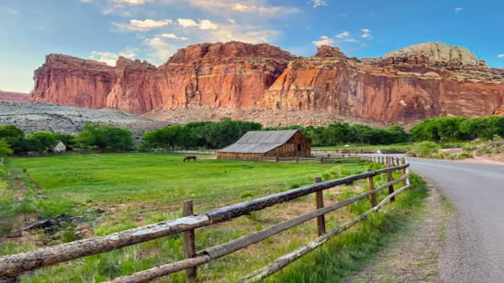
Most people plan a week in Utah, give Capitol Reef one afternoon, and leave wondering what the fuss was about. That’s the mistake. The hikes here don’t announce themselves from the road the way Zion’s or Arches’ do — you have to walk into them, through a wash or up a slickrock ridge, before the park shows you what it’s got.
Quick answer: The best all-around Capitol Reef hike is Cassidy Arch, a 3.4-mile round trip with 670 feet of gain that ends on top of a 400-foot sandstone arch. For an easier option, Hickman Bridge covers 1.8 miles round trip to a natural bridge. For something few visitors ever attempt, the slot canyons off Notom-Bullfrog Road — Burro Wash, Cottonwood Wash, Sheets Gulch — deliver Capitol Reef’s most memorable terrain.
Capitol Reef doesn’t have the crowds of Zion or Arches, and it doesn’t have their timed-entry systems either — you drive in, park, and walk. What it does have is 378 square miles built around the Waterpocket Fold, a nearly 100-mile wrinkle in the earth’s crust that the Navajo Sandstone cliffs follow like a spine. That geology is why the hikes here range from a 20-minute stroll to a canyoneering route with rappels.
Easy Capitol Reef Hikes (Good for Families)
If you’re short on time or hiking with kids, these two trails cover the park’s best scenery for the least effort.
Grand Wash Trail
This is less a hike than a walk through a canyon that happens to be spectacular. The trail follows a dry wash bed for 2.2 miles one-way (4.4 miles round trip), with sandstone walls that climb up to 800 feet and narrow to just 15 feet apart at the tightest point. There’s almost no elevation gain, which makes it one of the few Capitol Reef hikes a beginner or a six-year-old can finish without complaint. Watch for desert bighorn sheep along the canyon floor — they’re regulars here.
Hickman Natural Bridge Trail
The most popular trail in the park for a reason: 1.8 miles round trip, moderate but short climbing, ending at a 133-foot natural stone bridge. A trailhead brochure points out 17 stops along the way if you want the geology explained as you walk. Go early — this lot fills by mid-morning in spring and fall.
Quick Takeaway: If you only have two hours in Capitol Reef, do Grand Wash for the canyon and Hickman Bridge for the arch. Both are doable in tennis shoes.
Moderate Capitol Reef Hikes
This is where the park earns its reputation. Budget a half-day for any of these.
Cassidy Arch Trail
Named for outlaw Butch Cassidy, who allegedly used these canyons as a hideout. The trail climbs out of Grand Wash via switchbacks, gains around 670 feet over roughly 1.7 miles one-way, and ends on the slickrock plateau directly above the arch — you can walk right up to its edge. It’s exposed and there’s real drop-off near the rim, so this one isn’t for anyone uneasy with heights. Combine it with Grand Wash for a 7.5-mile loop if you want the full day.
Chimney Rock Loop
A demanding first quarter-mile of switchbacks gives way to a 3.6-mile loop with roughly 600 feet of total ascent and some of the best panoramic views in the park, looking out over the Waterpocket Fold toward Chimney Rock, a freestanding 300-foot spire. Rangers regularly point first-time visitors here over more famous trails, and they’re not wrong to.
Cohab Canyon Trail
A short, steep ascent from the Fruita historic district leads into a narrow canyon and out to overlooks of the orchards and the Fremont River valley below. It’s less crowded than Hickman Bridge and pairs well with a stop at the Gifford House for a slice of fruit pie afterward — genuinely one of the better small pleasures in any national park.
Strenuous, All-Day Capitol Reef Hikes
For hikers who want mileage and solitude, these two trails deliver both.
Navajo Knobs and Rim Overlook
Starting from the Hickman Bridge trailhead, this route splits off toward Rim Overlook at 2.3 miles (4.6 miles round trip, about 1,100 feet of gain) for a view 1,000 feet above the Fremont River Valley. Push on to Navajo Knobs and you’re looking at a 9.4-mile round trip with 1,620 feet of elevation change, ending with light scrambling to a 6,979-foot summit. Traffic thins out considerably past the Rim Overlook junction, so this is the hike to choose if the crowds at Hickman Bridge have already put you off.
Upper Muley Twist Canyon
Reached from the Burr Trail switchbacks well south of the main visitor center, this is a full-day, mostly trail-less route through a canyon studded with natural arches, finishing along a ridge-top walk with a panoramic view over the Fold. It gets less coverage than Cassidy Arch or Navajo Knobs, which is exactly why hikers who make the drive tend to call it the best trail in the park. Fall is the ideal season, both for cooler temperatures and canyon color; avoid it in peak summer heat.
Capitol Reef Slot Canyons (The Hikes Most Guides Skip)
Most Capitol Reef hiking guides stop at Cassidy Arch. That’s a mistake, because the park’s real backcountry character lives in its slot canyons, reached off Notom-Bullfrog Road south of Highway 24.
- Burro Wash — the most-traveled of the three, trailhead 7.8 miles down Notom-Bullfrog Road. Two miles of open wash lead into a narrowing canyon with chockstones to scramble around; the typical hike ends at an impassable pour-off 3.4 miles in.
- Cottonwood Wash — similar difficulty to Burro Wash, trailhead 9.1 miles down the same road, but noticeably quieter.
- Sheets Gulch — the least-traveled of the three, alternating between narrow slots and open sections.
None of these are maintained trails. Expect chockstones, occasional pools of water, and route-finding rather than signage. Never enter a slot canyon alone, and check the forecast — flash floods in narrow canyon terrain are a real and fast-moving hazard, not a theoretical one.
If you want the technical version of Cassidy Arch — rappels through the arches rather than a hike above them — that’s a canyoneering route requiring rope, harness, and a separate permit from the day hike.
Backcountry Hiking: Cathedral Valley and the Waterpocket District
Two very different backcountry regions bookend the park. Cathedral Valley, in the north, is a high-clearance drive through a landscape of sandstone monoliths that feels closer to Mars than Utah. The Waterpocket District, in the south, holds the multi-day routes — Upper and Lower Muley Twist Canyons, Halls Creek Narrows, and shorter options like Surprise, Red, and Headquarters Canyons, which run from one-hour walks to overnight backpacking trips. None of these routes are officially maintained, and cell service disappears the moment you leave the highway.
Trail Comparison at a Glance
| Trail | Distance (RT) | Elevation Gain | Difficulty | Best For |
|---|---|---|---|---|
| Grand Wash | 4.4 mi | Minimal | Easy | Families, first-timers |
| Hickman Bridge | 1.8 mi | ~400 ft | Easy–Moderate | Quick highlight |
| Cassidy Arch | 3.4 mi | ~670 ft | Moderate | Views, photos |
| Chimney Rock Loop | 3.6 mi | ~600 ft | Moderate | Panoramas |
| Cohab Canyon | 3.4 mi | ~400 ft | Moderate | Fewer crowds |
| Rim Overlook | 4.6 mi | ~1,100 ft | Strenuous | Solitude |
| Navajo Knobs | 9.4 mi | ~1,620 ft | Strenuous | Full-day summit |
| Upper Muley Twist | ~8–10 mi | Varies | Strenuous | Arches + ridge views |
| Burro Wash | ~6.8 mi | Minimal net | Strenuous/technical | Slot canyon scrambling |
Permits and Rules You Actually Need to Know
Capitol Reef has no timed-entry reservation and no day-use permit — the maintained trails covered above (Grand Wash, Hickman Bridge, Cassidy Arch, Chimney Rock, Cohab Canyon, Rim Overlook, Navajo Knobs) require nothing beyond the standard park entrance pass. Two other categories do require paperwork:
- Canyoneering permits — required for any technical descent (ropes, rappelling) inside the park, including routes like Cassidy Arch Canyon and Pandora’s Box. Currently free, obtained at a self-serve kiosk outside the visitor center or by email in advance. A separate permit is needed for each route, and group sizes are capped.
- Backcountry camping permits — required only if you’re sleeping overnight in the backcountry (Cathedral Valley primitive camping, Waterpocket District routes). Free, available at the visitor center from rangers only — not online.
Hiking the slot canyons (Burro Wash, Cottonwood Wash, Sheets Gulch) as a non-technical day hike, without rappelling, generally doesn’t require a permit — but always confirm current rules at the visitor center, since closures do happen to protect sensitive terrain.
Best Time to Hike Capitol Reef (and Flash Flood Safety)
Spring and fall are peak hiking season, and for good reason — daytime temperatures sit in a comfortable range and the higher-elevation trails stay accessible longer into early summer and earlier into autumn than lower-elevation parks like Zion. Summer hiking is doable on the shorter trails if you start at sunrise, but the slot canyons and exposed ridge trails (Cassidy Arch, Navajo Knobs) get punishing by midday.
Flash flood season runs roughly July through September, coinciding with the Southwest’s monsoon pattern. This matters most in the slot canyons and narrow sections of Grand Wash and Capitol Gorge, where a storm miles away can send a wall of water through a canyon with little warning. Check the forecast at the visitor center the morning of your hike, not the night before.
A Sample 1-Day and 3-Day Capitol Reef Hiking Itinerary
One day: Start at Hickman Bridge early to beat the heat and crowds. Midday, drive the Scenic Drive to Grand Wash and hike out to Cassidy Arch. Finish at Sunset Point near the visitor center for the evening light, then dinner in Torrey.
Three days:
- Day 1: Hickman Bridge, Cohab Canyon, Fruita orchards, Gifford House pie
- Day 2: Cassidy Arch combined with Grand Wash, or Chimney Rock Loop if you want a change of terrain
- Day 3: Navajo Knobs for a full-day push, or a slot canyon (Burro Wash) if you’re comfortable with route-finding and scrambling
Where to Stay and What to Bring
Torrey and Bicknell, 10–15 miles west of the park, have most of the hotels, fuel, and gear you’ll need; Loa has the nearest full grocery store. Note that many small-town businesses close on Sundays, so plan food and fuel accordingly. Dispersed BLM camping is available for free near the Burro Wash and Pandora’s Box trailheads and along side roads off Notom-Bullfrog Road.
Bring at least 2 liters of water per person for anything beyond Hickman Bridge — the exposed slickrock and wash trails pull moisture out of you faster than the temperature suggests. A sun hat and high-SPF sunscreen aren’t optional on the ridge and rim trails, and sturdy, grippy footwear matters more here than almost anywhere else in Utah, since several of the best hikes (Cassidy Arch, Chimney Rock) cross slickrock with real exposure.
Conclusion
Capitol Reef rewards hikers who go past the first pullout on Highway 24. Start with Hickman Bridge or Grand Wash if you’re easing in, work up to Cassidy Arch and Chimney Rock for the park’s signature views, and if you’ve got the time and the nerve, the slot canyons and Upper Muley Twist Canyon are where this park stops looking like a scenic drive and starts feeling like real backcountry. Check current trail and flash flood conditions at the visitor center before you set out, and build your plan around the trail comparison table above — it’ll save you from either underestimating Navajo Knobs or overpaying in effort for a short walk like Grand Wash.
If you’re planning another destination too, check out our Southwest USA travel guides for more trip ideas.
FAQ Section
What is the best hike in Capitol Reef National Park?
Cassidy Arch is the most-recommended overall hike — 3.4 miles round trip to a 400-foot sandstone arch you can walk out onto. For families or short timelines, Hickman Bridge or Grand Wash are the better picks.
Do you need a permit to hike in Capitol Reef?
No permit is needed for maintained day hikes like Hickman Bridge or Cassidy Arch. Permits are only required for technical canyoneering routes and overnight backcountry camping, both free at the visitor center.
How many days do you need to see Capitol Reef’s hikes?
One day covers the highlights (Hickman Bridge, Cassidy Arch, Sunset Point). Three days lets you add Chimney Rock, Navajo Knobs, and a slot canyon or backcountry route.
Is the Cassidy Arch hike scary?
It’s exposed near the arch’s edge with a real drop-off, but the trail itself isn’t technical. Anyone comfortable with heights and basic scrambling will be fine.
Can you hike Capitol Reef in summer?
Yes, but plan around the heat — start ridge and slot canyon hikes at sunrise, and avoid narrow canyons entirely during flash flood season (July–September) if storms are forecast.
What is the easiest hike in Capitol Reef?
Grand Wash Trail — nearly flat, 4.4 miles round trip through a canyon, suitable for beginners and most kids.
Are the slot canyons in Capitol Reef dangerous?
They can be, mainly from flash floods and chockstone obstacles. Never enter alone, check the forecast that morning, and know that some slot canyon experiences (like Cassidy Arch Canyon) require canyoneering gear and a permit.
How is hiking in Capitol Reef different from Zion or Arches?
Capitol Reef has no timed-entry system or shuttle, far fewer crowds, and a mix of maintained trails alongside true trail-less backcountry routes — its slot canyons and Waterpocket District routes are more remote than comparable hikes in Zion or Arches.