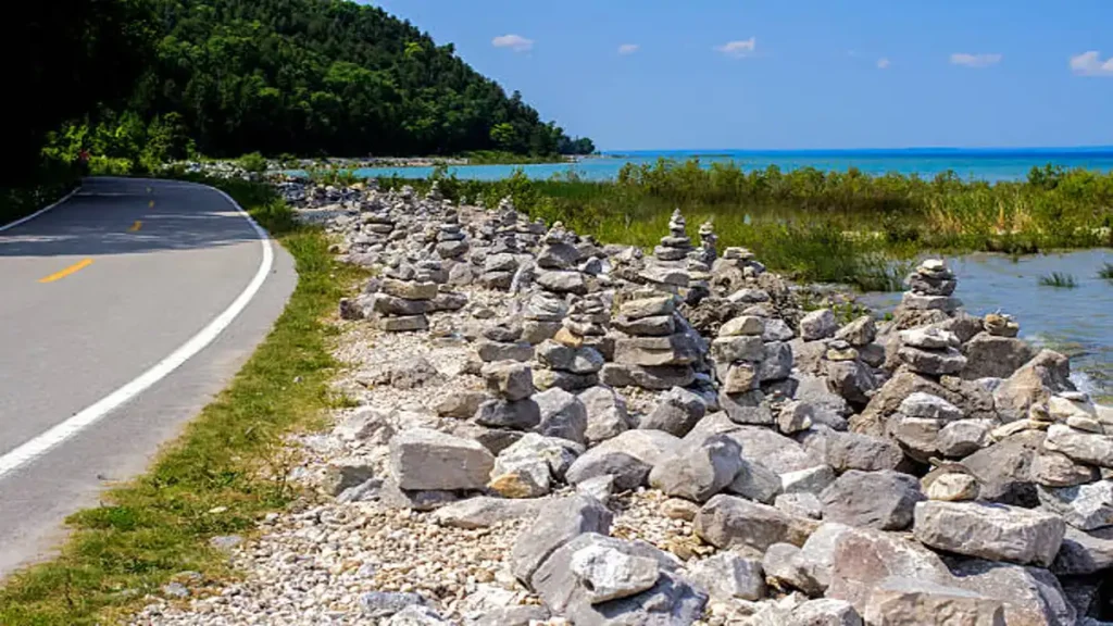
Most people picture Michigan as one long drive between fudge shops and lighthouses. That’s part of it. But if you actually want to hike — real trails, real elevation, real “I need water” moments — Michigan quietly rivals states three times its size.
A great Michigan road trip for hikers needs 7–10 days and should center on Sleeping Bear Dunes National Lakeshore and Pictured Rocks National Lakeshore, with Mackinac Island as a rest-day detour. Plan for June wildflowers, July–August swimming, or late August through early October for cooler hiking and fall color.
How Long Should Your Michigan Road Trip Be?
Michigan is the 11th-largest state in the country, and the driving distances catch people off guard every time. A loop from Detroit up through the Lower Peninsula, across the Mackinac Bridge, and back down can run close to 1,000 miles if you circle the whole “Mitten.”
For a trip built around hiking specifically, you don’t need the full loop. Four days covers Sleeping Bear Dunes and the Traverse City area at a reasonable pace. Seven days lets you add Mackinac Island and a first taste of the Upper Peninsula. Ten days is the sweet spot if Pictured Rocks and the far northern Keweenaw Peninsula are both on your list — that’s when the trip stops feeling rushed.
Quick takeaway: Weekend trip → Sleeping Bear Dunes only. One week → add Mackinac Island. Ten days → add Pictured Rocks and Munising.
Sleeping Bear Dunes: Michigan’s Best Hiking Home Base
Sleeping Bear Dunes National Lakeshore sits on Michigan’s northwest coast near Traverse City and Empire, and it’s where most hiking-focused road trips should start. The park protects 450-foot perched dunes above Lake Michigan, plus inland lakes, beech-maple forest, and some genuinely tough sand hiking.
You’ll need a park pass to use any lot inside the lakeshore — plan around $25 for a weekly vehicle pass, since daily passes aren’t sold here.
Top Trails and Their Difficulty
The Empire Bluff Trail is the one most locals point you toward first. It’s roughly 1.5 to 2 miles round trip through maple-beech forest to a bluff overlooking Lake Michigan and South Bar Lake, with a real shot at spotting South Manitou Island on a clear day. Don’t descend the bluff itself — it’s both dangerous and actively damaging to the dune ecosystem.
The Dune Climb is the trail everyone’s seen photos of, and it’s harder than it looks. Walking to Lake Michigan and back is closer to 3.5–4 miles round trip, entirely over soft, hot sand, and most people take about three hours. Bring more water than feels necessary.
If you want a longer forest walk with a payoff view, the Old Indian Trail and the hike up Alligator Hill to the Islands Lookout (about 1.5 miles) both deliver without the crowds of Empire Bluff.
Pierce Stocking Scenic Drive
This 7.4-mile loop road threads through the dunes and forest with 12 marked stops, several of them wheelchair accessible, overlooking Glen Lake and Lake Michigan. It’s the easiest way to see the scale of the dunes if your legs need a break for an afternoon.
Pictured Rocks and the Upper Peninsula
Cross the Mackinac Bridge and the terrain changes completely. Pictured Rocks National Lakeshore, near Munising, trades sand dunes for 200-foot painted sandstone cliffs above Lake Superior, plus waterfalls and swimming holes tucked into the forest.
Late August into early September tends to be the best window — warm enough to swim, cool enough to hike comfortably, and before fall crowds peak. Popular short hikes include Miners Castle and the Sand Point Marsh Trail. One thing worth checking before you go: the Munising Falls Trail has been closed since an April 2025 washout, so confirm current park alerts before building it into your plan.
Extending North to Houghton and Isle Royale
If you’ve got the extra days, Houghton and the Keweenaw Peninsula sit far enough north that your phone may briefly welcome you to Canada. From here, Isle Royale National Park is reachable by seaplane directly from Houghton or by ferry from Copper Harbor — a genuine bucket-list add-on rather than a quick stop.
The Gold Coast and Small-Town Stops
Not every day needs to be a hike. Michigan’s western shoreline — the “Gold Coast” — runs about 366 miles from Saugatuck up to Mackinaw City along M-22 and US-31, passing orchards, vineyards, and beach towns the entire way.
Traverse City works well as a home base night: wineries, cherry orchards, and a walkable downtown after a day on the trail. Frankenmuth, about 90 minutes from Detroit, is a worthwhile detour if you’re starting from the south — Bavarian-style architecture and Bronner’s CHRISTmas Wonderland make it a strange but memorable stop.
Mackinac Island deserves its own half-day at minimum. No cars are allowed, so you’re biking or walking past the Grand Hotel and around the island’s perimeter road — a genuine change of pace from hiking boots and trailheads.
A Realistic 7-Day Sample Itinerary
| Day | Focus | Overnight |
|---|---|---|
| 1 | Detroit or Grand Rapids to Traverse City, stop in Frankenmuth if starting east | Traverse City |
| 2 | Sleeping Bear Dunes: Empire Bluff + Pierce Stocking Drive | Traverse City or Empire |
| 3 | Dune Climb, Leelanau Peninsula wineries, M-22 drive | Traverse City |
| 4 | Drive north, cross Mackinac Bridge, ferry to Mackinac Island | Mackinac Island |
| 5 | Morning on the island, afternoon drive toward Munising | Munising |
| 6 | Pictured Rocks hikes and boat tour | Munising |
| 7 | Return south via Grand Rapids, optional Gold Coast stop | — |
What It Actually Costs (Passes, Ferries, Gas)
Budget realistically: Sleeping Bear Dunes’ weekly vehicle pass runs about $25. Mackinac Island ferry tickets and Pictured Rocks boat cruises both sell out in peak summer and fall-color weekends, so book those ahead rather than assuming you’ll grab a same-day spot. Gas adds up fast on the longer legs — the Detroit-to-Munising drive alone is a solid five-plus hours — so factor a full tank or two extra into your budget beyond lodging and food.
Packing and Trail Etiquette
Bring more water than you think you need for both the Dune Climb and any Pictured Rocks cliff-edge hike — there’s little shade on either. Sturdy shoes matter more at Sleeping Bear than people expect; sand hiking is a different workout than solid trail. And on bluff trails like Empire Bluff, stay on the marked path. Descending the dune face isn’t just a safety risk — it accelerates erosion in an ecosystem that takes decades to recover.
A Michigan road trip built around hiking rewards a little patience: fewer stops, more time on trail, and a season chosen for the weather you actually want rather than just when you have vacation days. Start with Sleeping Bear Dunes, decide from there whether Pictured Rocks and the UP fit your timeline, and build the rest of the route around those two anchors.
For more inspiration like this, take a look at our complete hiking and outdoor guides.
FAQ Section
How many days do you need for a Michigan road trip?
Four days covers Sleeping Bear Dunes and Traverse City comfortably. A week adds Mackinac Island. Ten days lets you also reach Pictured Rocks and the Upper Peninsula without rushing.
What is the best time of year for a Michigan road trip?
June brings wildflowers at Sleeping Bear Dunes; July–August is best for swimming; late August into early September is ideal for Pictured Rocks; October delivers fall color statewide.
Is Sleeping Bear Dunes or Pictured Rocks better for hiking?
Sleeping Bear Dunes suits families and first-timers with shorter, easier trails and beach access. Pictured Rocks suits hikers chasing dramatic cliff views, waterfalls, and a wilder Lake Superior setting.
How much does a Sleeping Bear Dunes park pass cost?
A vehicle pass runs about $25 for a full week; daily passes aren’t offered, so it covers your whole visit regardless of how many days you stay.
Can you do Michigan’s Upper Peninsula in one trip?
Yes, but treat it as an extension rather than an add-on — Munising alone deserves two to three days, and reaching Houghton or Isle Royale needs several more.
What’s the hardest hike near Sleeping Bear Dunes?
The Dune Climb to Lake Michigan and back, at roughly 3.5–4 miles entirely over soft sand, surprises most visitors with how physically demanding it is compared to a standard forest trail.
Do you need reservations for Mackinac Island ferries?
Reservations aren’t always mandatory, but booking ahead is strongly recommended during summer weekends and fall color season, when crossings sell out.
Is Munising Falls Trail open?
As of the most recent park updates, the Munising Falls Trail remains closed following an April 2025 washout — check current National Park Service alerts before planning around it.